
West Michigan trail signs aim to make exploring easier, safer
West Michigan Trails plans consistent signs to improve navigation, accessibility, and emergency response along more than 300 miles of routes.
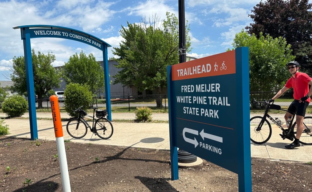
West Michigan has more than 850 miles of trails, according to West Michigan Trails’ guide. But where trails meet, join roads, or lead to places you don’t know, finding your way can be difficult.
“Wayfinding is part of a regional mobility system, the missing link that transforms disconnected trails and infrastructure into one regional network,” says John Morrison, executive director of West Michigan Trails. “It changes behavior by helping people choose walking and bicycling with confidence.”
West Michigan Trails plans to add signs along more than 300 miles of trails and bike routes on streets across its 18-county region. The nonprofit has received more than $2 million in federal funds through the Michigan Department of Transportation’s Transportation Alternatives Program.
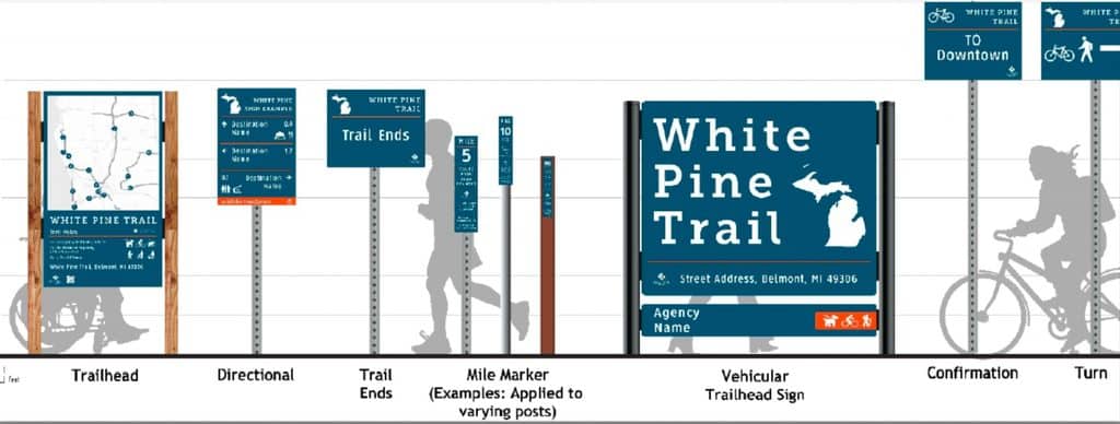
The signs will do more than point the way. Large letters, colors that stand out, and simple symbols can help new trail users, people who have trouble seeing, and those who speak little English. People shared nearly 1,000 responses to help the group choose the design.
The group still needs more money. The grant covers about 80% of the cost of adding signs. It does not pay for the group’s work and other costs. West Michigan Trails needs to raise about $750,000 from local groups and donors. The signs should go up in 2027 and 2028.
Rapid Growth Media spoke with Morrison about the signs, who they could help, and what it will take to put them up.
Rapid Growth: Can you give me some background on West Michigan Trails? When and why was the organization created, and how has its work evolved over the years?
John Morrison: West Michigan Trails began in the late ‘90s as friends groups and interested parties getting together to look for ways to connect three early trails in West Michigan: Kent Trails, Musketawa Trail, and the White Pine Trail (now the Fred Meijer White Pine Trail State Park). They were also part of a master plan process to connect trails and communities throughout the West Michigan region. With the help of Fred Meijer and others, West Michigan Trails became a 501(c)3 nonprofit in 2005 in order to raise funds for six trails in that master plan. WMT worked on getting those trails built over the next 10 to 12 years.
As the trails were nearing completion, West Michigan Trails was looking for its future role with trails. Through stakeholder input and focus groups, it was decided that we would look at the regional trail network as a whole and help get it connected and working as an active transportation network.
RG: How did the idea for a regional wayfinding system come about, and what problems were you seeing with the way people navigate West Michigan’s trail network?
JM: Wayfinding is part of a regional mobility system, the missing link that transforms disconnected trails and infrastructure into one regional network. It changes behavior by helping people choose walking and bicycling with confidence. And we are creating a model that can be replicated across Michigan.
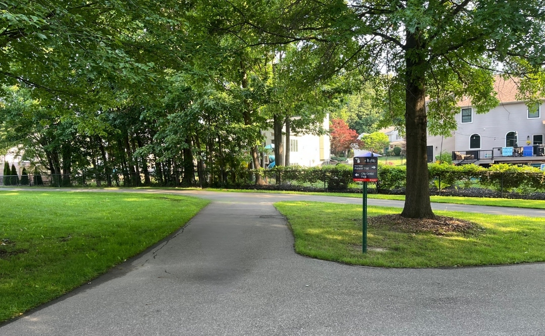
Early trails were built individually and were not part of a larger network. Also, trails were hard enough to get built, and signage was often an afterthought. Many trails don’t have much more than the required regulatory signs such as stop signs. As more trails were built and a network of trails started coming together, the need for wayfinding or directional signage began to emerge.
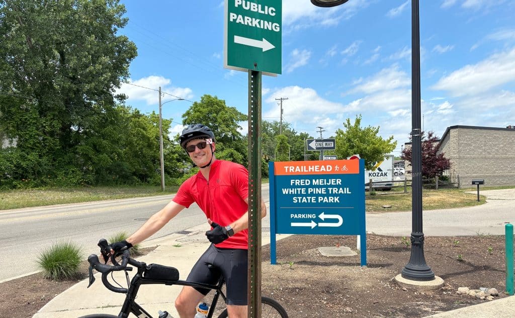
It may seem simple to “just follow the trail,” but the trail may navigate a difficult intersection or join another trail. Currently, coming off the Fred Meijer White Pine Trail in Comstock Park, you can’t tell which way to go to get to Grand Rapids. A trail user may be looking for water, food, a place to repair their bicycle, or simply their destination. A trail user needing medical help has to describe to 911 and EMS where they are on the trail.
The MDOT Grand Region Regional Nonmotorized Plan in 2017 identified consistent trail signage as a priority. West Michigan Trails took up that challenge to create a wayfinding guide to consistently sign trails and on-road bicycle facilities. It was important, and an additional challenge, that the signs work on both because trails often come into communities where there’s no room for a separated trail but on-road facilities are available. Signs on those facilities are important and must meet road regulations.
No single community can solve regional connectivity alone. West Michigan Trails exists to bring everyone to one table. MDOT, counties, municipalities, state agencies, nonprofits, and more are all part of this effort. Creating the guide was the first phase. This grant is for the important second phase of implementation on 300 miles of trail. From there, we will continue with the focus of getting the program implemented on trails throughout the region.
RG: The project will bring consistent wayfinding signs to more than 300 miles of trails and on-street bicycle routes across 18 counties. What will be different for someone using those trails once the project is completed?
JM: Think of this like driving to California. You can follow signs on the roads across counties and state lines, and those signs are consistent. You know what to look for. Our trail network or active transportation network needs that same consistency. When you’re using a trail under your own power – walking or bicycling – you want to have the confidence that you’re going in the right direction and understand what is around you. Signage will even help people explore more; for example, seeing that a town or park or destination is only X distance farther, knowing that it’s within your capacity, and deciding to continue.
Good signage will help people get from point A to point B confidently and help them explore more. That opens the door to more people using the system as a meaningful mode of transportation.
RG. What did you learn from trail users and the public testing that influenced the final design, particularly when it comes to accessibility, people who are less familiar with the trails, and emergency response?
JM: In developing the wayfinding guide, three different sign families were designed. We put samples of those side-by-side on numerous trails around the region. What was interesting is that our timeline had those samples displayed in October and November (typically when there is less trail usage), and even so our consultant said we had a record number of responses, nearly a thousand. People were really interested in seeing good signs on the trails. We had a QR code where they could vote on the different designs, colors, icons, fonts, and more, and from that, we developed the final design.
For emergency response, we worked with state-level 911 and EMS, and they said to use “What3Words.” In that system, the world is divided into 10-foot squares. Each square has a unique three-word code, and from that code, 911 and EMS can locate you. We’ll have the three words on the mile markers, and we’ll also educate trail users to download the What3Words app so they can use it even when they’re not near a mile marker.
Implementation of signage on the trails and network will be designed toward tourism. A tourist is unfamiliar with the trails and what is around them. If the signs work for tourists, they will work for everyone. The trail system should feel equally welcoming, whether you’re a lifelong cyclist or discovering trails for the first time. Everybody should feel welcome on trails, including first-time trail users, families, older adults, visitors, people unfamiliar with an area or with language barriers, and people who don’t use expensive cycling technology.
RG: You’ve secured more than $2 million in federal funding, which covers about 80% of the project. How much do you need to raise for the local match, how are you approaching that fundraising, and what is the timeline for getting signs installed?
JM: The grant does not cover WMT time and costs in the project, so those are in addition to the project cost. With the grant in place, we need to raise about $750,000. Much of that will be covered by municipalities and trail managers covering the 20 percent match for their trails, and we expect private fundraising to be between $250,000 and $350,000. That will come from a combination of individual and foundation funding.
For the timeline, we’re expecting to secure a contractor in the coming months and the implementation being in ’27 and ’28.
West Michigan Trails will host its Fall Trail Summit from 9 to 11:30 a.m. Thursday, Oct. 22, at the MLK Community Center, 900 Fuller Ave. SE in Grand Rapids. Register here.
A panel will explore opportunities and challenges related to micromobility on trails. Panelists will include representatives from the League of Michigan Bicyclists, Michigan Department of Natural Resources, Rails 2 Trails, Michigan Trails & Greenways, Kent County Parks, the city of Grand Rapids and the Grand Rapids Police Department.
Photos courtesy of West Michigan Trails
Author

Related Articles
Grand Rapids improves access to help everyone enjoy the city
Local groups work with people with disabilities to improve access, share travel details and make Grand Rapids easier to explore.
The wheels on the bus go ’round and ’round: Grand Rapids’ Central Station Early Childhood Center
The Rapid takes mom and dad to work -– and the littles to a brand new daycare opening in September 2026.
Designer’s accessibility sticker encourages communities to rethink who automatic doors serve
Grand Rapids designer Aidan Van Doren created an accessibility sticker showing automatic doors benefit parents, workers, older adults, and people with disabilities.


